Land marks

Land & Monuments

623d7aacb7935

FORT JAMES

Fort James is situated on James Island about 30km up-river from the mouth of the River Gambia. He history of James Island is unusual in that it reflects political events in Europe, events which had a very direct bearing on the people of The Gambia but which were by and large, beyond the control of the Gambian ethnic groups. The trade forts of West African were set up to primarily defend the interests of the European traders and James Fort (as it is more typically known now) was no exception. Throughout its history this was its main function, but through the periods of peace the fort had a much basic role. It was like a Fortified Company Office (the base of operations for the various trade groups) and it monitored all river traffic and allowed for the collection of levies on river transport. The Europeans that manned the fort were either commercial, military, or professional in background.

623d7b752a2ef

San Domingo, Juffureh

Located near the shoreline of the river, San Domingo was the foreign quarter of an old Portuguese trade post and the main sub-station for James Island. It was established by the Portuguese in the late 15th century by Luso-African traders who had settled there to act as host-brokers and middlemen for the Europeans.

623d7c23985df

Fort Bullen

Fort Bullen was the largest fort built by the Europeans in The Gambia and it remains in good condition today. It is basically rectangular, with circular bastions at each corner. On at least three of the bastions three of the bastions were traversing gun carriages which supported Blomefield iron 32 powder cannons. It lies on a penisula only a few metres above sea level and stands very close to the end of the point where the tide laps the foreshore on three sides of the fort. The fourth side of the fort faces a tract of land under rough grass. This landward side is bordered o the north by a line of trees and on the south by the new and old rest houses over looking the river.

623d7ce52a199

Six-Gun Battery

located in Banjul on the south bank of the mouth of the river opposite Fort Bullen.

623d7d6f70b72

Wassu & Kerr Batch Stone Circles

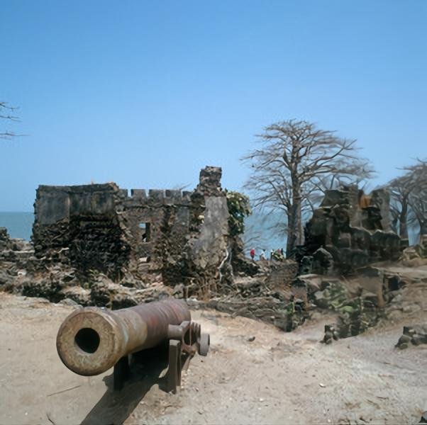
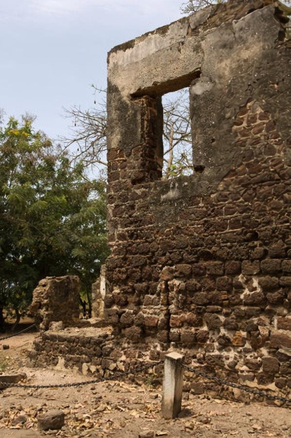
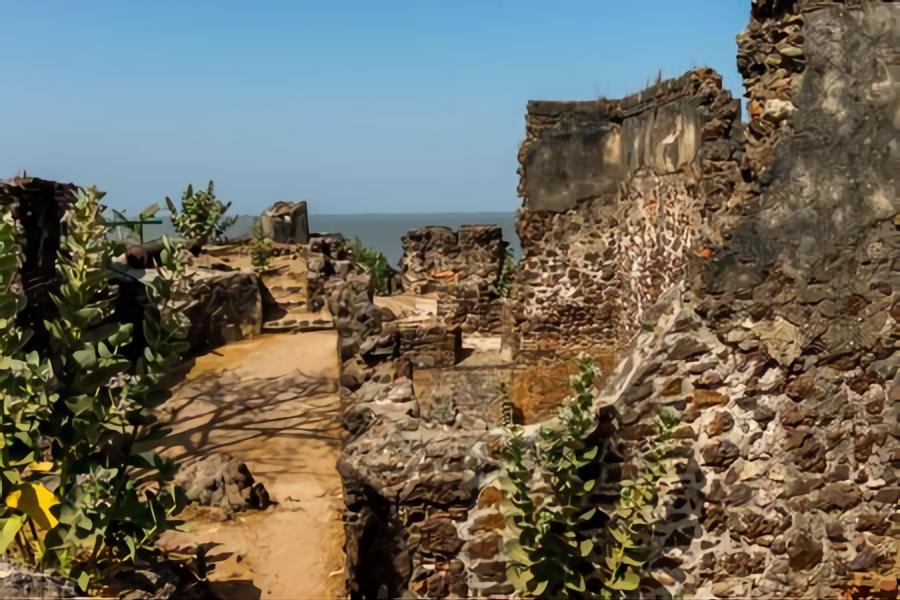
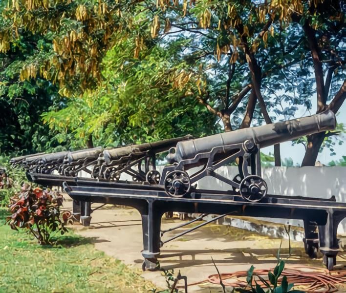
According to the World Heritage Committee’s citation, “these sites together present a testimony to the main periods and facets of the encounter between Africa and Europe along the River Gambia, a historical continuum stretching from pre-colonial and pre-slavery times to independence. The site is particularly significant for its relation to the beginning of the slave trade and its abolition and also documents early access to the interior of Africa”.

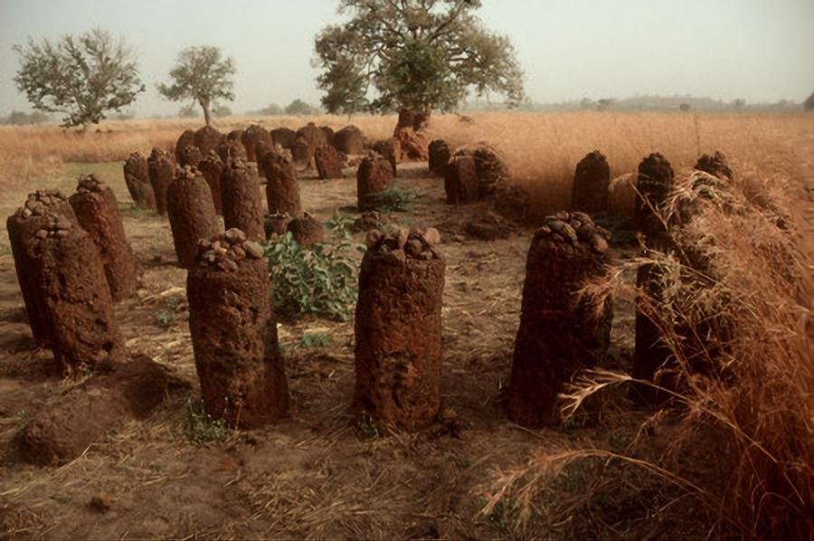
The Stone Circles of the Senegambia, the second Gambian world heritage site was listed in 2006 under criteria I and iii. This is also a serial inscription and consists of four sites, two of which are found in Senegal (Sine Ngayene and Wanar), and the other two in The Gambia (Wassu and Kerbatch). The four large groups of stone circles represent an extraordinary concentration of over 1,000 monuments in a band 100 km wide along some 350 km of the River Gambia. The four groups cover 93 stone circles and numerous tumuli and burial mounds, some of which have been excavated to reveal material that suggest dates between 3rd century BC and 16th century AD. Together the stone circles of laterite pillars and their associated burial mounds present a vast sacred landscape created over more than 1,500 years, and reflect a prosperous, highly organized and lasting society1.